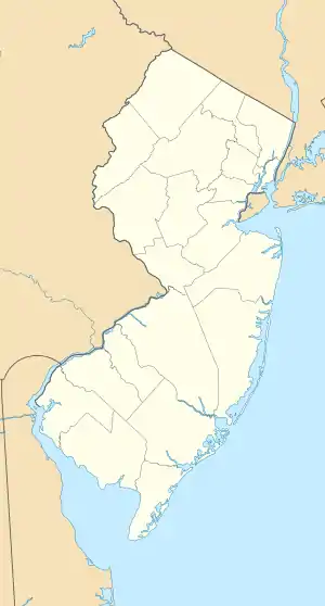
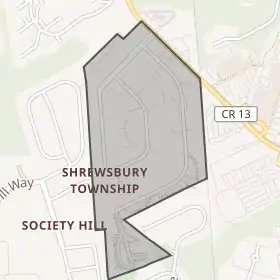
Шрусбері Тауншип (Нью-Джерсі)
Шрусбері Тауншип (англ. Shrewsbury Township) — селище (англ. township) в США, в окрузі Монмаут штату Нью-Джерсі. Населення — 1141 осіб (2010[1]).
| Селище
Координати 40°18′48″ пн. ш. 74°04′18″ зх. д.
| |||||||||||||||||||||||||||||||||||||
Демографія
| Історія переписів | |||
|---|---|---|---|
| Перепис | Населення | Зміна в % | |
| 1790 | 4673 | — | |
| 1810 | 3773 | * | — |
| 1820 | 4824 | 27.9% | |
| 1830 | 4700 | −2.6% | |
| 1840 | 5917 | 25.9% | |
| 1850 | 3182 | * | −46.2% |
| 1860 | 4132 | 29.9% | |
| 1870 | 3354 | * | −18.8% |
| 1880 | 3842 | * | 14.5% |
| 1890 | 4222 | 9.9% | |
| 1900 | 3842 | * | −9.0% |
| 1910 | 3238 | * | −15.7% |
| 1920 | 1944 | −40.0% | |
| 1930 | 1052 | * | −45.9% |
| 1940 | 1347 | 28.0% | |
| 1950 | 1388 | 3.0% | |
| 1960 | 1204 | * | −13.3% |
| 1970 | 1164 | −3.3% | |
| 1980 | 995 | −14.5% | |
| 1990 | 1098 | 10.4% | |
| 2000 | 1098 | 0.0% | |
| 2010 | 1141 | 3.9% | |
| Оцінка 2016 | 1009 | [4][5] | −11.6% |
| Джерела: 1790-1920[6] 1840[7] 1850-1870[8] 1850[9] 1870[10] 1880-1890[11] 1890-1910[12] 1910-1930[13] 1930-1990[14] 2000[15][16] 2010[17][18][19] * = Відокремленя частини території.[20] | |||
Згідно з переписом 2010 року[1], у селищі мешкала 1141 особа в 583 домогосподарствах у складі 266 родин. Було 648 помешкань
Расовий склад населення:
|
До двох чи більше рас належало 3,9 %. Частка іспаномовних становила 14,1 % від усіх жителів.
За віковим діапазоном населення розподілялося таким чином: 18,8 % — особи молодші 18 років, 63,2 % — особи у віці 18—64 років, 18,0 % — особи у віці 65 років та старші. Медіана віку мешканця становила 41,9 року. На 100 осіб жіночої статі у селищі припадало 82,6 чоловіків; на 100 жінок у віці від 18 років та старших — 76,2 чоловіків також старших 18 років.
Середній дохід на одне домашнє господарство становив 60 421 долар США (медіана — 50 909), а середній дохід на одну сім'ю — 78 916 доларів (медіана — 58 281). Медіана доходів становила 47 031 долар для чоловіків та 37 589 доларів для жінок.[Прим. 1] За межею бідності перебувало 16,3 % осіб, у тому числі 36,0 % дітей у віці до 18 років та 9,1 % осіб у віці 65 років та старших.
Цивільне працевлаштоване населення становило 644 особи. Основні галузі зайнятості: мистецтво, розваги та відпочинок — 17,5 %, роздрібна торгівля — 17,1 %, освіта, охорона здоров'я та соціальна допомога — 14,0 %.
Примітки
- Річний дохід на особу, яка працювала на повну ставку. Оцінка в доларах 2015 року.
Джерела
- American FactFinder. Бюро перепису населення США. Процитовано 16-06-2019.(англ.)
- Look Up a ZIP Code for Shrewsbury, NJ, United States Postal Service. Accessed August 1, 2012.
- Zip Codes, State of New Jersey. Accessed October 23, 2013.
- PEPANNRES - Annual Estimates of the Resident Population: 1 квітня 2010 to 1 липня 2016 - 2016 Population Estimates for New Jersey municipalities Архівовано 30 квітня 2020 у Wayback Machine., Бюро перепису населення США. Accessed 16 червня 2017.
- Census Estimates for New Jersey 1 квітня 2010 to 1 липня 2016, Бюро перепису населення США. Accessed 16 червня 2017.
- Compendium of censuses 1726-1905: together with the tabulated returns of 1905, New Jersey Department of State, 1906. Accessed 20 липня 2013.
- Bowen, Francis. American Almanac and Repository of Useful Knowledge for the Year 1843, p. 231, David H. Williams, 1842. Accessed 20 липня 2013.
- Raum, John O. The History of New Jersey: From Its Earliest Settlement to the Present Time, Volume 1, p. 252, J. E. Potter and company, 1877. Accessed 20 липня 2013. "Shrewsbury township is level the southern part being sandy the soil is fertile and contains excellent farming land. It was settled by emigrants from Connecticut in 1664. Lewis Morris of Barbadoes, the uncle of Lewis Morris, Governor of New Jersey, carried on iron works here. The village of Red Bank is pleasantly situated on the Navesink river two miles from Shrewsbury and five from the ocean. In 1830 it contained but two houses but is now one of the most thriving villages in the state. It has an extensive trade with New York in vegetables, wood, and oysters. Population in 1870, 2,086." Data listed covers only Red Bank, not Shrewsbury Township.
- Debow, James Dunwoody Brownson. The Seventh Census of the United States: 1850, p. 140. R. Armstrong, 1853. Accessed 7 грудня 2012.
- Staff. A compendium of the ninth census, 1870, p. 260. Бюро перепису населення США, 1872. Accessed 7 грудня 2012. Population for Shrewsbury Township of 5,440 included the population of 2,086 for Red Bank, with the population for Shrewsbury Township alone calculated via subtraction.
- Porter, Robert Percival. Preliminary Results as Contained in the Eleventh Census Bulletins: Volume III - 51 to 75, p. 99. Бюро перепису населення США, 1890. Accessed 1 серпня 2012. Population is listed for Shrewsbury Township including Red Bank town as 6,526 in 1880 and 8,367 in 1890, while population for Red Bank town is listed as 2,684 in 1880 and 4,145 in 1890, with results for the two years calculated by subtracting the Red Bank town only total from the combined total.
- Thirteenth Census of the United States, 1910: Population by Counties and Minor Civil Divisions, 1910, 1900, 1890, Бюро перепису населення США, p. 338. Accessed 30 липня 2012.
- Fifteenth Census of the United States : 1930 - Population Volume I, Бюро перепису населення США, p. 717. Accessed 30 липня 2012.
- Table 6. New Jersey Resident Population by Municipality: 1930 - 1990 Архівовано 2015-05-10 у Wayback Machine., New Jersey Department of Labor and Workforce Development. Accessed 28 червня 2015.
- Census 2000 Profiles of Demographic / Social / Economic / Housing Characteristics for Shrewsbury township, Monmouth County, New Jersey, Бюро перепису населення США. Accessed August 1, 2012.(англ.) Наведено за англійською вікіпедією.
- DP-1: Profile of General Demographic Characteristics: 2000 - Census 2000 Summary File 1 (SF 1) 100-Percent Data for Shrewsbury township, Monmouth County, New Jersey Архівовано 12 лютого 2020 у Archive.is, Бюро перепису населення США. Accessed August 1, 2012.(англ.) Наведено за англійською вікіпедією.
- DP-1 - Profile of General Population and Housing Characteristics: 2010 for Shrewsbury township, Monmouth County, New Jersey Архівовано 12 лютого 2020 у Archive.is, Бюро перепису населення США. Accessed August 1, 2012.(англ.) Наведено за англійською вікіпедією.
- Municipalities Grouped by 2011-2020 Legislative Districts Архівовано 4 червня 2019 у Wayback Machine., New Jersey Department of State, p. 6. Accessed January 6, 2013.(англ.) Наведено за англійською вікіпедією.
- Profile of General Demographic Characteristics: 2010 for Shrewsbury township Архівовано 7 вересня 2014 у Wayback Machine., New Jersey Department of Labor and Workforce Development. Accessed August 1, 2012.(англ.) Наведено за англійською вікіпедією.
- Snyder, John P. The Story of New Jersey's Civil Boundaries: 1606-1968, Bureau of Geology and Topography; Trenton, New Jersey; 1969. p. 185. Accessed October 23, 2012.(англ.) Наведено за англійською вікіпедією.


